Visual record · Reading the territory at different scales
Map of Totonacapan: towns in Veracruz and northern Puebla, Gulf coastline and four archaeological sites
The map locates places and helps identify their relationships. The readings move between scales: from the region to the coast and highlands, and from landscapes to the circulation of people and knowledge.
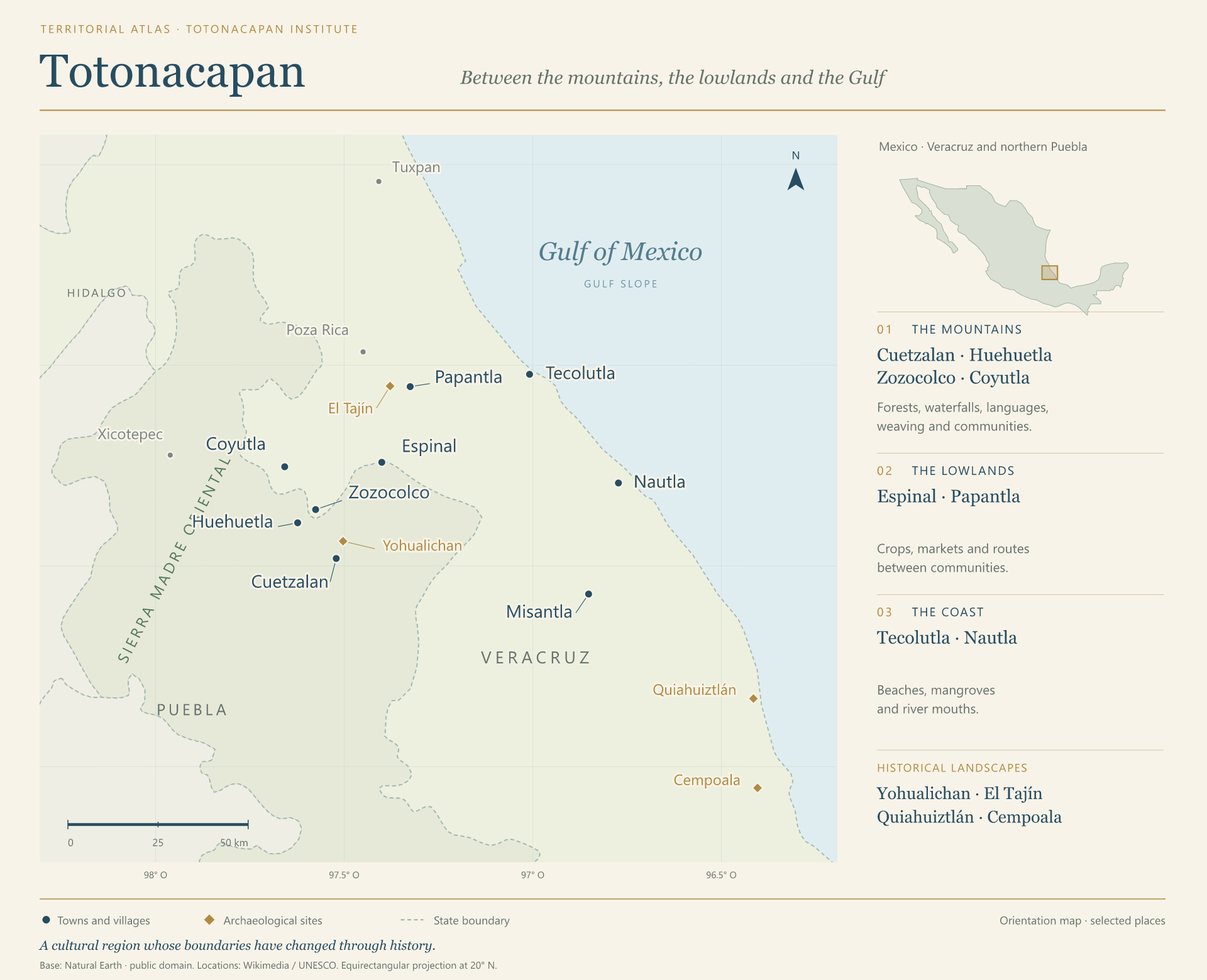
The lines on this map are state boundaries. The points bring together present-day towns and historical sites; Totonacapan’s cultural boundaries have changed over time.